Tucson's Norte-Sur Plan
Welcome
Tucson Norte-Sur is a plan that will work with Tucson communities to identify opportunities for equitable reinvestment and access along a future 15-mile long North-South High Capacity Transit (HCT) corridor connecting the Tucson Mall on the northside to downtown Tucson and to the Tucson Airport on the southside.
Project Overview + Purpose
In June 2020 the City of Tucson was awarded a grant from the Federal Transit Administration’s Pilot Transit-Oriented Development (TOD) Planning Program(External link). The funding was used to develop a strategic plan to guide future land use and real estate investments, infill development, and growth within the communities surrounding an important regional North-South transit corridor. The Norte-Sur Plan project area extends approximately ¾-1 mile on both sides of the approximately 15-mile corridor, which begins at Tohono Tadai Regional Transit Center and includes Oracle Road on the north side of downtown, South 6th Avenue on the south side, and ends at the Tucson International Airport. This project is being led by the City of Tucson Department of Transportation and Mobility, working alongside the Planning and Development Services Department, and the Housing and Community Development Department, as well as the City of South Tucson.

Tucson Norte-Sur: Investing in Resilient Communities + Transit
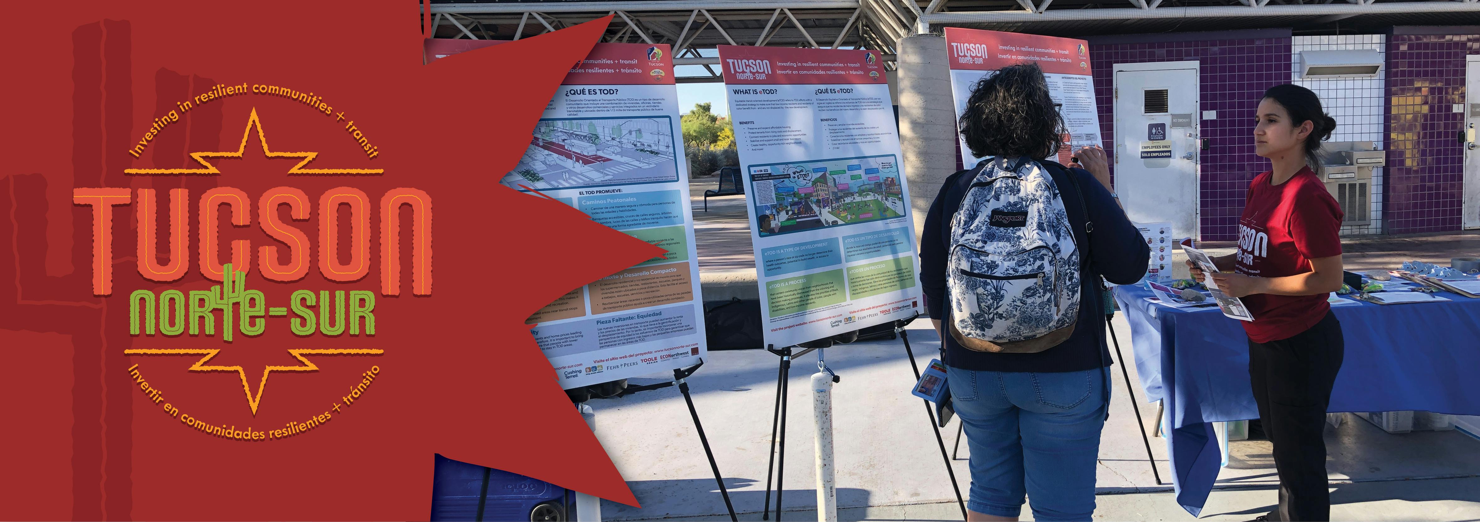
 Tucson Norte-Sur is an Equitable transit oriented development (eTOD) strategic planning project for a north-south corridor stretching from the Tucson Mall/Tohono Tadai Transit Center in the north to Tucson International Airport in the south. Transit oriented development (TOD) is a planning and design approach that seeks to create compact, mixed-use, pedestrian-oriented neighborhoods around new or existing public transit stations. Many transit advocates, planners, community-based developers, and others have embraced TOD as a strategy to create more vibrant and connected neighborhoods, increase transit ridership, expand opportunity, and reduce the greenhouse emissions that contribute to climate change. However, the high demand for housing adjacent to transit can make TOD homes inaccessible to people with lower incomes, while the rapid appreciation sparked by new transit investments can lead to gentrification and displacement, countering equity goals.
Equitable transit oriented development (eTOD) refers to TOD efforts that are undertaken with an explicit commitment to achieve equity goals through dedicated strategies that ensure low-income residents and residents of color benefit from – and are not displaced by – the new development. With strategies in place to preserve and expand affordable housing, protect tenants from rising costs and displacement, connect residents to jobs and economic opportunities, stabilize and support small and local businesses, and more, eTOD can foster equitable development, creating healthy, opportunity-rich neighborhoods.
Equitable TOD, or eTOD, incorporates affordability and accessibility into all aspects of traditional Transit-Oriented Development. This approach builds vibrant, walkable, mixed-use neighborhoods near transit stops and stations so that all people, regardless of income, race, age, or ability, have access to jobs, basic services, and amenities.
What are the benefits of eTOD for community members?
 Walkability
Pedestrian-friendly elements create vibrant and active spaces, which lead to health, environmental and economic benefits.
Mixed Use
A mix of land uses within a building, block or neighborhood encourages fewer car trips and creates people-focused spaces.
Density
Compact development connects people to jobs and goods and services, and supports public transit infrastructure.
Transit
Transit contributes to equitable development by expanding access to opportunities and providing convenient, reliable transportation services.
Affordability
Equity-focused policy ensures affordable housing options near transit, low-cost transit fares and tenant protection.
What the Tucson Norte-Sur Plan DOES and DOES NOT do
The Tucson Norte-Sur project is a land-use planning effort that will work with Tucson communities to develop a vision, goals, policy framework, and strategies to support - Vibrant, inclusive neighborhoods
- Building community wealth, ownership, stability, and providing an opportunity to thrive
- Incremental development that matches the character of the surrounding area (historical, cultural, environmental)
- A mix of multifamily housing types, such as apartment buildings, duplexes, triplexes, townhomes, and condos
- Support local/legacy residents, families, and businesses
- Job creation that employs local residents
- Adding amenities and public gathering spaces
| The Tucson Norte-Sur plan DOES NOT include: - Funding for capital projects, such as the construction of transit*
- Selection of a specific transit type
- Specific corridor alignments or roadway changes
- Planning for transit operations
- Specific site plans around potential transit stops
|
*A separate study is underway regarding a potential Bus Rapid Transit system in this corridor. For more information, on Tucson Rapid Transit, click here.
Planning Areas
North Side
The North Side subarea, which encompasses the area between Speedway and the Rillito River, includes historic motor courts with Route 66-era neon signs along Oracle Rd and Miracle Mile, iconic local businesses along Stone Ave, the largest shopping destination in Tucson at the Tucson Mall, Pima Community College, a connection to the Loop Trail network, and the Thrive in the 05 planning subarea.
While much of the corridor has followed an auto-oriented development pattern in recent years with big box stores, the Oracle Rd bus route 16 has among the highest ridership in the SunTran system, and recent planning efforts through Thrive in the 05 aim to transform the 85705 zip code into walkable, connected neighborhoods that build on the area’s unique history as a mid-century Tucson tourism gateway.
Downtown
The greater downtown area has seen substantial investment as a result of transit-oriented development tools. The 4-mile streetcar connects downtown, the University of Arizona, 4th Avenue and the west side. In addition to the streetcar, the Ronstadt Transit Center downtown serves more than 20 bus lines. Through a combination of transportation investments, land use tools, and economic incentives, downtown has seen substantial growth in housing, jobs and businesses since the launch of the streetcar in 2014. The Infill Incentive District, the zoning tool that has facilitated much of the development in the greater downtown area, is up for renewal in January 2023 and is currently being updated, in coordination with this effort.
South Tucson
The City of South Tucson covers an area of about 1.2 square miles and is completely surrounded by the City of Tucson, Arizona. It is located at the junction of Interstate 19 and Interstate 10 about 1 mile south of downtown Tucson. It is bounded on three sides by two freeways and the Union Pacific railroad tracks. Incorporated in 1940 and known as the 'Pueblo Within a City', the City of South Tucson has maintained a strong and unique character and cultural heritage. South Tucson's ethnic character is evident in its widely known Mexican restaurants and its architectural styles, including colorful outdoor tile murals.
South Side
The South Side planning area covers a large area, bounded by I-19 on the north and the Tucson International Airport on the south. In addition to the airport, the South Side is home to many large institutions and employers, such as the Rodeo Grounds and the Veterans Hospital. The South Side corridors identified as part of the Norte-Sur plan include S. 6th Ave, Irvington Rd, Park Ave, and Valencia Rd, each of which has it’s own unique character. The South Side is primarily residential and auto-oriented, but has seen substantial growth, particularly in the industrial sector, and is an emerging jobs hub.
Tucson's Norte-Sur Plan
Welcome
Tucson Norte-Sur is a plan that will work with Tucson communities to identify opportunities for equitable reinvestment and access along a future 15-mile long North-South High Capacity Transit (HCT) corridor connecting the Tucson Mall on the northside to downtown Tucson and to the Tucson Airport on the southside.
Project Overview + Purpose
In June 2020 the City of Tucson was awarded a grant from the Federal Transit Administration’s Pilot Transit-Oriented Development (TOD) Planning Program(External link). The funding was used to develop a strategic plan to guide future land use and real estate investments, infill development, and growth within the communities surrounding an important regional North-South transit corridor. The Norte-Sur Plan project area extends approximately ¾-1 mile on both sides of the approximately 15-mile corridor, which begins at Tohono Tadai Regional Transit Center and includes Oracle Road on the north side of downtown, South 6th Avenue on the south side, and ends at the Tucson International Airport. This project is being led by the City of Tucson Department of Transportation and Mobility, working alongside the Planning and Development Services Department, and the Housing and Community Development Department, as well as the City of South Tucson.
Tucson Norte-Sur: Investing in Resilient Communities + Transit
Tucson Norte-Sur is an Equitable transit oriented development (eTOD) strategic planning project for a north-south corridor stretching from the Tucson Mall/Tohono Tadai Transit Center in the north to Tucson International Airport in the south. Transit oriented development (TOD) is a planning and design approach that seeks to create compact, mixed-use, pedestrian-oriented neighborhoods around new or existing public transit stations. Many transit advocates, planners, community-based developers, and others have embraced TOD as a strategy to create more vibrant and connected neighborhoods, increase transit ridership, expand opportunity, and reduce the greenhouse emissions that contribute to climate change. However, the high demand for housing adjacent to transit can make TOD homes inaccessible to people with lower incomes, while the rapid appreciation sparked by new transit investments can lead to gentrification and displacement, countering equity goals.
Equitable transit oriented development (eTOD) refers to TOD efforts that are undertaken with an explicit commitment to achieve equity goals through dedicated strategies that ensure low-income residents and residents of color benefit from – and are not displaced by – the new development. With strategies in place to preserve and expand affordable housing, protect tenants from rising costs and displacement, connect residents to jobs and economic opportunities, stabilize and support small and local businesses, and more, eTOD can foster equitable development, creating healthy, opportunity-rich neighborhoods.
Equitable TOD, or eTOD, incorporates affordability and accessibility into all aspects of traditional Transit-Oriented Development. This approach builds vibrant, walkable, mixed-use neighborhoods near transit stops and stations so that all people, regardless of income, race, age, or ability, have access to jobs, basic services, and amenities.
What are the benefits of eTOD for community members?
Walkability
Pedestrian-friendly elements create vibrant and active spaces, which lead to health, environmental and economic benefits.
Mixed Use
A mix of land uses within a building, block or neighborhood encourages fewer car trips and creates people-focused spaces.
Density
Compact development connects people to jobs and goods and services, and supports public transit infrastructure.
Transit
Transit contributes to equitable development by expanding access to opportunities and providing convenient, reliable transportation services.
Affordability
Equity-focused policy ensures affordable housing options near transit, low-cost transit fares and tenant protection.
What the Tucson Norte-Sur Plan DOES and DOES NOT do
The Tucson Norte-Sur project is a land-use planning effort that will work with Tucson communities to develop a vision, goals, policy framework, and strategies to support - Vibrant, inclusive neighborhoods
- Building community wealth, ownership, stability, and providing an opportunity to thrive
- Incremental development that matches the character of the surrounding area (historical, cultural, environmental)
- A mix of multifamily housing types, such as apartment buildings, duplexes, triplexes, townhomes, and condos
- Support local/legacy residents, families, and businesses
- Job creation that employs local residents
- Adding amenities and public gathering spaces
| The Tucson Norte-Sur plan DOES NOT include: - Funding for capital projects, such as the construction of transit*
- Selection of a specific transit type
- Specific corridor alignments or roadway changes
- Planning for transit operations
- Specific site plans around potential transit stops
|
*A separate study is underway regarding a potential Bus Rapid Transit system in this corridor. For more information, on Tucson Rapid Transit, click here.
Planning Areas
North Side
The North Side subarea, which encompasses the area between Speedway and the Rillito River, includes historic motor courts with Route 66-era neon signs along Oracle Rd and Miracle Mile, iconic local businesses along Stone Ave, the largest shopping destination in Tucson at the Tucson Mall, Pima Community College, a connection to the Loop Trail network, and the Thrive in the 05 planning subarea.
While much of the corridor has followed an auto-oriented development pattern in recent years with big box stores, the Oracle Rd bus route 16 has among the highest ridership in the SunTran system, and recent planning efforts through Thrive in the 05 aim to transform the 85705 zip code into walkable, connected neighborhoods that build on the area’s unique history as a mid-century Tucson tourism gateway.
Downtown
The greater downtown area has seen substantial investment as a result of transit-oriented development tools. The 4-mile streetcar connects downtown, the University of Arizona, 4th Avenue and the west side. In addition to the streetcar, the Ronstadt Transit Center downtown serves more than 20 bus lines. Through a combination of transportation investments, land use tools, and economic incentives, downtown has seen substantial growth in housing, jobs and businesses since the launch of the streetcar in 2014. The Infill Incentive District, the zoning tool that has facilitated much of the development in the greater downtown area, is up for renewal in January 2023 and is currently being updated, in coordination with this effort.
South Tucson
The City of South Tucson covers an area of about 1.2 square miles and is completely surrounded by the City of Tucson, Arizona. It is located at the junction of Interstate 19 and Interstate 10 about 1 mile south of downtown Tucson. It is bounded on three sides by two freeways and the Union Pacific railroad tracks. Incorporated in 1940 and known as the 'Pueblo Within a City', the City of South Tucson has maintained a strong and unique character and cultural heritage. South Tucson's ethnic character is evident in its widely known Mexican restaurants and its architectural styles, including colorful outdoor tile murals.
South Side
The South Side planning area covers a large area, bounded by I-19 on the north and the Tucson International Airport on the south. In addition to the airport, the South Side is home to many large institutions and employers, such as the Rodeo Grounds and the Veterans Hospital. The South Side corridors identified as part of the Norte-Sur plan include S. 6th Ave, Irvington Rd, Park Ave, and Valencia Rd, each of which has it’s own unique character. The South Side is primarily residential and auto-oriented, but has seen substantial growth, particularly in the industrial sector, and is an emerging jobs hub.


Thank you for your contribution!
Help us reach out to more people in the community
Share this with family and friends